Introduction
The precise localization and mapping of processes, movements, and interactions of organisms and influencing factors are key to the understanding of the ecosystems on this planet. Our planet. Humanity’s first scientific endeavors focused on the description of their environment, and thanks to recent advances in technology, we’ve made incredible leaps in mapping Earth and the Universe in an unprecedented resolution. But up until recently, our approaches have been limited to 2 dimensions, like paper maps and computer screens. This is changing now. Due to the affordability of technology, it is finally possible to render our environment in more dimensions than left/right and up/down. All life as we currently know it exists in a 3D space. To understand and display the interplay, trajectories, and dynamics of organisms and their interaction with key environmental factors, the comprehension of space is vital. This approach promises unparalleled and unprecedented insights into the only livable habitat we currently know: Earth.
This project is conducted in collaboration with Dr. Mike A. Gil and Heather Hillard (UC Davis, SciAll.org)
%
Project Progress
Sectors scanned
Editing 3D scan of Acropora florida
Aim
We’re in the final stages of rendering a functional, high res render of a ecologically important section of Mae Had, and implementing 7 years worth of data through mixed effect models. Additionally, 2 field seasons of incredibly high resolution fish trajectories are being overlaid, and the whole model is currently ported to a immersive VR environment by Dave Woolridge.
In the future, we’ll do all of Koh Phangan. The process is quite data intensive, and just Mae Had has generated Terabytes of data, which is quite challenging. But who cares, it’s just work for computers – and a lot of time.
Screen video of scalable COLLADA model, rendered in MacOS Preview, low resolution
2D render of VR flyby animation, low resolution (pixelated) model. The full render has texture of 2.4 cm per pixel
Methodology
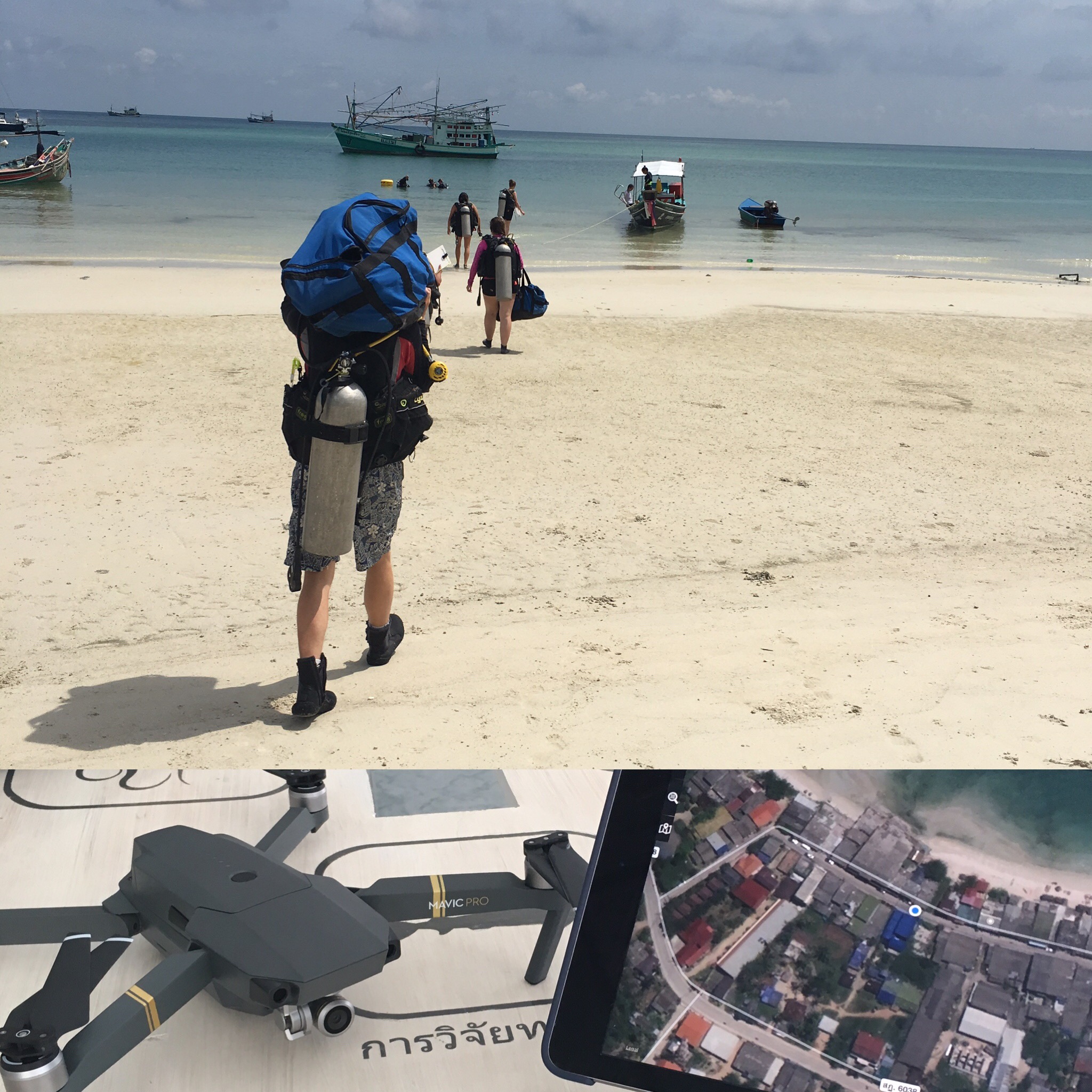
We’re in the final stages of developing a reproducible methodology, and hope to publish a fully comprehensive methods paper soon. As a general overview, we work with a combination of established photogrammetry, structure from motion, underwater and aerial photography – at a unprecedented scale.
Stay tuned for more

Outlook
After Mae Had, we’ll render Koh Phangan. After Koh Phangan, the (tropical) world. The method is easy enough to be done by any technically adapt person. As high resolution models can be created with an action cam and a consumer grade drone (UAV), this is a great chance for a global public science project. We’re currently testing cloud computing infrastructure, in the near future you should be able to upload your data and receive a fully rendered model of your ecosystem from us.
Stay tuned.
PHOTO
GRAMMETRY
Photogrammetry is the science of making measurements from photographs, especially for recovering the exact positions of surface points. Photogrammetry is as old as modern photography, dating to the mid-19th century and in the simplest example, the distance between two points that lie on a plane parallel to the photographic image plane, can be determined by measuring their distance on the image, if the scale (s) of the image is known. […]
STRUCTURE
FROM MOTION
Structure from motion (SfM) is a photogrammetric range imaging technique for estimating three-dimensional structures from two-dimensional image sequences that may be coupled with local motion signals. It is studied in the fields of computer vision and visual perception. In biological vision, SfM refers to the phenomenon by which humans (and other living creatures) can recover 3D structure from the projected 2D (retinal) motion field of a moving object or scene.[…]
GIS
SYSTEMS
A geographic information system (GIS) is a system designed to capture, store, manipulate, analyze, manage, and present spatial or geographic data. The acronym GIS is sometimes used for geographic information science (GIScience) to refer to the academic discipline that studies geographic information systems and is a large domain within the broader academic discipline of geoinformatics.[1] What goes beyond a GIS is a spatial data infrastructure, a concept that has no such restrictive boundaries.[…]